This guide to Navaho Peak includes everything you need to know before this stunning hike in Wenatchee National Forest. It ascends around 6.75 miles to the summit of Navaho Peak at an elevation of over 7,000'!
Navaho Peak in Washington is one of the most stunning hikes you'll find in the Pacific Northwest. If you're looking for a challenging and rewarding experience, then a Navaho Peak hike is definitely something you should consider.

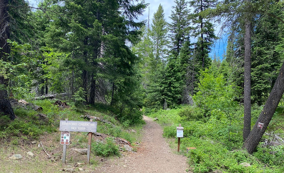
Located in the Teanaway area of Washington State, this 7,223′ peak is a gorgeous, easy day hike along the Stafford Creek Trail. It is on the boundary of the Alpine Lakes Wilderness and provides incredible views of the Stuart Range.
Trailhead Coordinates: 47.38259151255437, -120.7996358376502
Know Before You Go
Navaho Peak Permit: You need a Northwest Forest Pass or National Parks Pass to park in the lot. A Discover Pass will earn you a ticket, even on weekdays. If you don’t have a pass, you can fill out a one-day parking slip at the trailhead for $5.00.
Dogs allowed: Yes! Dogs are allowed on this trail. Pups of many sizes do well on this trail.
Camping: Camping is allowed along the trail. The most popular spot is in a meadow just below Navaho Pass.
Make sure to check out Traverse the Pacific Northwest's guide to the Navaho Pass Campground.
Geography
Navaho Peak is a stunning mountain located in the Cascade Range of Washington State. The peak stands at 7,157 feet and offers spectacular views of the surrounding area. Its majestic summit towers over the surrounding terrain, providing hikers with a breathtaking vista of the nearby peaks.
The mountain range in which Navaho Peak lies in the North Cascades. It is an incredibly rugged range that is home to some of Washington's most beautiful scenery. With its soaring peaks, deep glacial valleys, and countless glaciers, it truly is an awe-inspiring sight.
Navaho Peak itself is made up of a variety of rock types, ranging from metamorphic rocks such as gneiss and schist to sedimentary rocks like sandstone and limestone. All of these types of rock provide a unique look and feel to the mountain and its surroundings. Visitors can also enjoy the presence of quartz veins and basalt columns that were formed by the tremendous forces of volcanic activity millions of years ago.
Navaho Peak Hike
An absolutely gorgeous, gradual climb up to Navaho Pass and stunning views of the Enchantments. Climbing Navaho Peak isn't easy. But it also isn't the hardest mountain hike in Wenatchee National Forest.
Distance | Elevation Gain | Time Required | Difficulty |
|---|---|---|---|
13.5 miles | 4,400 | 6-9 hours | 7/10 |
Navaho Peak Trail Map

The trail gains around 4,400 feet in elevation over 7.25 miles to the summit. half the elevation comes within the first 3/4ths of the hike and the second half over the course of your climb up the ridgeline. Despite the severe-sounding (and looking) elevation graphs, this climb inspires, it's not nearly as steep or sandy as it seems like it's going to be.

The trail continues to steadily gain elevation as it switchbacks up towards Navaho Pass. There are several places to get water at this point as the trail stays next to the river until leaving the camping meadow before Navaho Pass. Take the trail right around the meadow and into a desert-like section of the mountain. The path steepens here as it heads towards the pass.
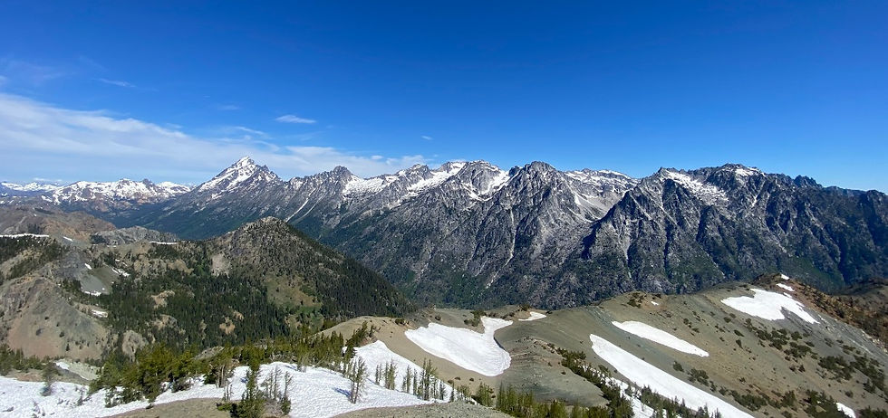
Get your camera ready as you step onto the notch and get your first view of the Stuart Range, and the Enchantments spread out in front of you. Straight ahead, you get an unusual view of Dragontail Peak, Ingalls Peak, Little Annapurna, Argonaut Peak, Colchuck Peak, The Temple, and more!

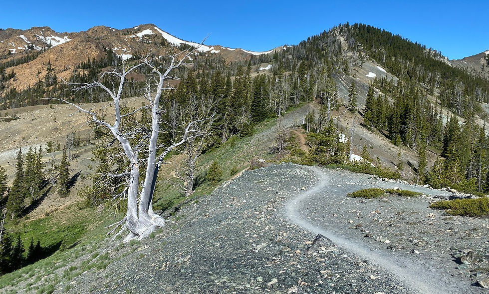
Take the ridgeline to your right. This is the last section of the trail but it's also the steepest.

As you climb, stay on the lookout for Mount Stuart popping into
view behind you and slightly to the right. On a clear day, you may also get to see Mount Rainier and Mount Adams on the other side of the ridge.
The top is small but large enough to fit several groups. Make sure to admire the expansive, 360-degree view before heading back down the same way you came.

Flora and Fauna
Navaho Peak, located in the North Cascades of Washington, is home to a wide variety of flora. On your hike to the peak, you'll be surrounded by lush trees like western hemlock, Douglas-fir, western red cedar, and grand fir. These trees provide shade and protection from the elements and create a great habitat for other plants and animals.
You'll also find wildflowers like yellow violets, thimbleberry, and Indian paintbrush that bloom during the summer months. There are also plenty of mushrooms and ferns, as well as lichens on the rocks and trees.
While trekking around Navaho Peak, you may encounter a variety of animals, such as black bears, mountain goats, marmots, deer, grouse, and elk. Keep an eye out for smaller creatures like squirrels and chipmunks who love to scurry around the mountainside. You may also spot bald eagles flying overhead.
Camping on the trail to Navaho Peak is allowed. There are several well-established areas where groups or individuals choose to camp. There is no camping permit required.
Be aware that camping areas are very popular due to the relative ease of getting to these scenic areas with a bag.

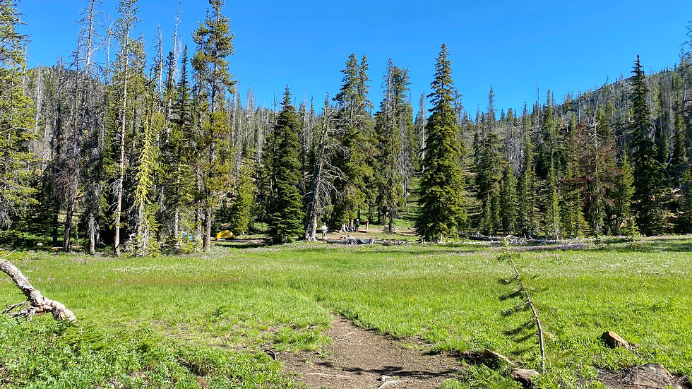
About 5 miles up the trail, you encounter the above beautiful flat meadow. This is by far the most popular spot for camping. There are no bathrooms, but there are a few fire pits and nearby running river water. On all sides of the meadow are spots for camping among the shade of the trees.
It's common to find people camping here as they make multiple trips on the trails around Navaho, including up the Three Brothers. The trail heads right around the meadow and up an exposed, desert-like section of the trail towards Navaho Pass and then the ridgeline.
Navaho Peak Weather
The average temperatures at Navaho Peak are:
Summer: Highs - 70s Lows-30's
Winter: Highs - 30s Lows-10s
Navaho Peak is best climbed in spring, summer, and early fall. Earlier in the season, there may be too much snow on the ridgeline to make route-finding and hiking enjoyable, and even a few patches of ice on the rockier sections.


Comments